The Dec. 26, 2004 Indian Ocean tsunami that originated near Sumatra claimed nearly a quarter-million lives in 12 countries, making it one of the deadliest natural disasters in human history. The devastating global impact of the tsunami prompted cities across the U.S. to better gauge the risk tsunamis pose to their coastal communities. According to the National Tsunami Hazard Mitigation Program, 489 cities in Alaska, California, Hawaii, Oregon, and Washington are susceptible to tsunami inundation, with an estimated 900,000 people living or working within areas that could be inundated by a 50-foot tsunami. Find out how tsunamis could occur in these cities and which coastal communities are at greatest tsunami risk.
How could a tsunami occur?
A tsunami is a series of large waves that occurs when water in the sea is rapidly displaced on a massive scale. There are four main ways this can occur: (1) an undersea earthquake (2) an undersea landslide (3) a large meteorite hitting the ocean (4) a submarine volcanic eruption. In the case of the Indian Ocean tsunami, an earthquake triggered a tsunami that spread thousands of miles over several hours.
At first, the waves of the tsunami in deep water are very far apart—sometimes hundreds of miles—and the waves move very fast–sometimes around 500 miles per hour. Out at sea, these waves are barely noticeable because the waves reach only a few feet above the rest of the surface. But, once the waves leave the deep water, the tsunami’s speed slows, its wavelength decreases and its height increases greatly. Essentially, since there is less depth for the water to move in, the only way for the waves to move is up.
This results in a large wall of water that ends up crashing onto the beach. Behind the initial wave front is still a large volume of water that washes further inland. Because the tsunami contains immense energy from the giant waves, it can travel very far and very fast with little overall energy loss. In the case of the Indian Ocean tsunami, the path of destruction reached from Sri Lanka and Thailand to as far as Somalia on the east coast of Africa, 2, 800 miles west of the tsunami’s origin.
Tsunami Risk Zones and Hazard Scenarios:
All oceans can experience tsunamis, but in the Pacific Ocean and its surrounding seas, there is a much more frequent occurrence of large, destructive tsunamis because of the many large earthquakes along the Pacific Rim.
The National Oceanic and Atmospheric Administration determined in 2006 that the Pacific coast states of Alaska, California, Hawaii Oregon and Washington have the greatest tsunami risk. Puerto Rico and the U.S. Virgin Islands are also at great tsunami risk. And, while tsunamis are extremely rare in the Atlantic, there is still a hazard risk along the East and Gulf coast.
While there is still much that needs to be done before coastal communities are equipped to deal with the potential disaster of tsunamis, the National Oceanic and Atmospheric Administration (NOAA) is working with U.S. coastal areas at greatest tsunami risk, including Alaska, California, Hawaii, Oregon and Washington, to get multiple warning mechanisms in place. Since the 2004 Indian Ocean tsunami, NOAA has created detailed relief maps to predict the impact of tsunamis and flood threats on these coastal cities. The detailed snapshots are used to create computer models to forecast the magnitude and extent of coastal flooding that a tsunami could trigger. See how some of these coastal communities are mapping the local risk of tsunamis:
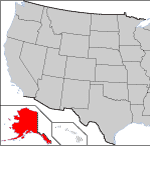 Alaska:
Alaska has the greatest earthquake and tsunami potential in the entire United States.
- Inundation Mapping – Alaska Data Assessment (NOAA)
- Tsunami Hazard Mapping of Alaska Coastal Communities (NOAA)
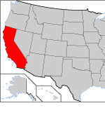 California:
According to a 2005 report from the California Seismic Safety Commission, Tsunami waves generated by a large offshore earthquake could threaten at least 1 million coastal residents in California.
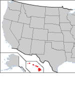 Hawaii:
Hawaii is the state at greatest risk for a tsunami. They get about one a year, with a damaging tsunami happening about every seven years.
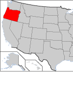 Oregon:
Geologists predict a 10-14 percent chance that a tsunami will be triggered by a shallow, undersea earthquake offshore Oregon in the next 50 years. The forecast comes from evidence for large but infrequent earthquakes and tsunamis that have occurred at the Oregon coast every 500 years, on average, according to the Oregon Department of Geology.
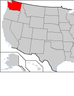 Washington:
The Washington portion of the Cascadia subduction zone produces a great earthquake (magnitude 8 or 9) and associated tsunami often enough for the next of these to have a one-in-ten chance, or better, of occurring in the next 50 years, according to the Washington Military Department Emergency Management Division. The NOAA Center for Tsunami Research modeled tsunami inundation from a great Cascadia Subduction Zone earthquake for the coastal communities of Long Beach and Ocean Shores, Washington.
Additional Resources:
- Newsweek: The Tsunami Threat: Though extremely rare, killer waves can be less predictable–and more destructive–than the quakes that cause them
- National Oceanic and Atmospheric Administration (NOAA): NOAA is an agency that enriches life through science. Our reach goes from the surface of the sun to the depths of the ocean floor as we work to keep citizens informed of the changing environment around them.
- NOAA: Tsunami Forecasting: NOAA’s Combined, measurement and modeling techniques can provide reliable tsunami forecasts.
- PBS: Savageearth: A diagram explaining tsunami formation.
- Time Magazine: Special Report Tsunami: The world suffers an epic tragedy as a tsunami spreads death across Asia. An on-the-scene look at how it happened — and whether the carnage could have been avoided
- National Geophysical Data Centre: The high-resolution, edited bottom pressure recording data, along with accompanying metadata, from 1986 to 2004 can be downloaded, viewed and plotted from this site.
- Federal Emergency Management Agency (FEMA): The primary mission of the Federal Emergency Management Agency is to reduce the loss of life and property and protect the Nation from all hazards, including natural disasters.
- International Tsunami Information Center: ITIC maintains and develops relationships with scientific research and academic organizations, civil defense agencies, and the general public in order to carry out its mission to mitigate the hazards associated with tsunamis by improving tsunami preparedness for all Pacific Ocean nations. ITIC is also assisting in the development and implementation of tsunami warning and mitigation systems globally.