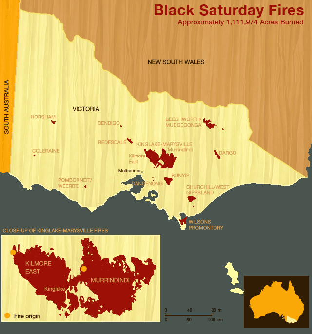
In February 2009, conditions were ripe for wildfires in the state of Victoria. Relentless heat waves, non-existent rainfall, and strong winds sweeping in from the outback plagued the region. On Saturday, February 7, a series of bush fires broke out across southeastern Australia, decimating over one million acres of Mountain Ash forests. Below is a map showing the location and size of the different fires tied to Black Saturday.